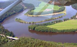
Lužnice river is the right tributary of the Vltava river. They joins near the town Týn nad Vltavou at the beginning of the Kořensko Dam.
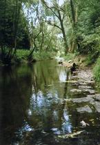
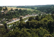
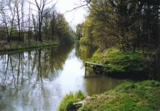
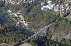
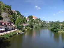
Lužnice river springs in Austria on the western slope of Aichelberg mountain, 920 m a.s.l. It is in the Austrian part of the Novohradské Hory (Nové Hrady Mountains) and the river is called Lainsitz there. About 4 km far from the spring the Lužnice river forms the boundary line (about 3 km), then it runs back to Austria and soon returns to Bohemia. First it runs through the wooded region around České Velenice and then it heads to the north to the Třeboňská Pánev (Třeboň Basin) with many ponds, which were built along the river in the 15th and 16th centuries. A small river called Dračice empties into Lužnice from the right side behind the small town Suchdol nad Lužnicí. The Zlatá Stoka (Golden Canal), about 48 km long, branches out of the river, to the right, near the huge weir called Pilař. The other canal, Nová Řeka (New River), branches out of the river also to the right side near the small village Majdalena. The original bed between the villages Majdalena and Stará Hlína with many meanders is protected in the nature reserves Meandry Lužnice (Meanders of the Lužnice river) and the Stará Řeka (Old River). The river passes the town Třeboň and is called the Stará Řeka in this part as well. North of the town it feeds the largest Czech pond called Rožmberk. Then the Lužnice runs to the town Veselí nad Lužnicí, where it takes back water from the Zlatá Stoka canal and the Nežárka river (from the right side). The river then goes by the peat-bog Borkovická Blata (Borkovice Marshland) to the towns Soběslav and Tábor, where the valley becames rocky, narrower and deeper. The watercourse curves sharply to the south-west in Tábor. Not far from Tábor the Vlásenický Potok (Vlásenice Stream) empties into the Lužnice river, which continues near the ruins of the Příběnice and Dobronice castles to the spa town Bechyně. Approximately in the middle of Tábor and Bechyně, near the village Stádlec, the unique suspension bridge spans the river. A small river called Smutná (Unhappy) and a stream called Židova Strouha (Jew's Flume), which runs through the narrow canyon, emptie into Lužnice in Bechyně. Then the river leads through the wooded region to the village Koloděje nad Lužnicí, where the Orlík Dam begins, and in the direction of the town Týn nad Vltavou. It empties into the Vltava river ahead of the town near the small village Neznašov.
 |
 |
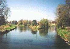 |
Lužnice is a typical slow lowland river with many weirs and its stream runs quickly only during spring thaw or strong rains. The whole flow in the Czech Republic is suitable for water sports. It is a centre of canoeing and the best navigable part begins in Suchdol nad Lužnicí.
The river is 208 km long and it takes water from an area 4,226 square km large.
 |
 |
 |
The red marked tourist trail leads along the river from Rožmberk pond, through Veselí nad Lužnicí and then to the small village Dráchov. The blue and yellow marked trails run between the small town Planá nad Lužnicí and Tábor near the river as well. The most interesting part of the river valley from Tábor to the confluence with the Vltava river is marked by the red sign.