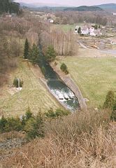
The dam lies on the Úhlava river about 4 km south of the town Nýrsko and 19 km south-east of the town Klatovy.
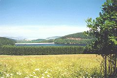
The construction of the revetment finished in 1969. It is 36 m high and 337 m long. The dam holds a water reservoir, which contains about 16 million cubic metres of water. Its maximal depth is 34 m and it is 148 ha large and 3 km long. It is used as a source of drinkable water for the town Nýrsko and the villages in the surroundings.
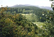
The dam can be found near the road from Nýrsko to the town Železná Ruda (4 km). The yellow marked path leads from the dam along the western bank of the dam to the small village Hojsova Stráž. The green sign runs along the eastern bank in its southern side.
 |
 |
 |