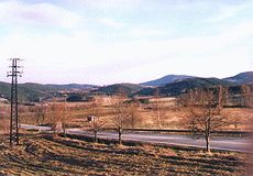
The large and rugged Šumavské Podhůří (Šumava Foothills) adjoins the Šumava mountains (Bohemian Forest) in the north. The large area (2,407 square km) has six geomorphological parts.
In the western part there is the Strážovská Vrchovina (Strážov Uplands) with the highest peak Želivský Vrch (Želiv Hill - 769 m).
The near Svatoborská Vrchovina (Svatobor Uplands), which is named according to the highest hill Svatobor (845 m), lies around the town Sušice.
The town Vimperk and its surroundings lie in the part called Vimperská Vrchovina (Vimperk Uplands) with the highest peaks Bělčí (922 m) and Mářský Vrch (Mářský Hill - 907 m).
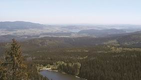
The so-called Prachatická Hornatina (Prachatice Highlands) joins the inland range of the Šumava mountains. The highest peak - Libín mountain (1,096) - towers above the centre of this region - the town Prachatice.
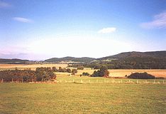
The north-eastern part of the Šumavské Podhůří forms the Bavorovská Vrchovina (Bavorov Uplands). It is the largest part and it extends from the towns Sušice and Horažďovice (in the west) to the towns Bavorov and Vodňany (in the east). The southern border joins the Českobudějovická Pánev (České Budějovice Basin). The highest peak called Na Stráži is 700 m high.
The Českokrumlovská Vrchovina (Český Krumlov Uplands) lies in the south-eastern part of the Šumavské Podhůří and its highest mountain is Velký Plešný (Big Plešný - 1,066 m).
|
|
|